UAEN

Kharkiv Metro map

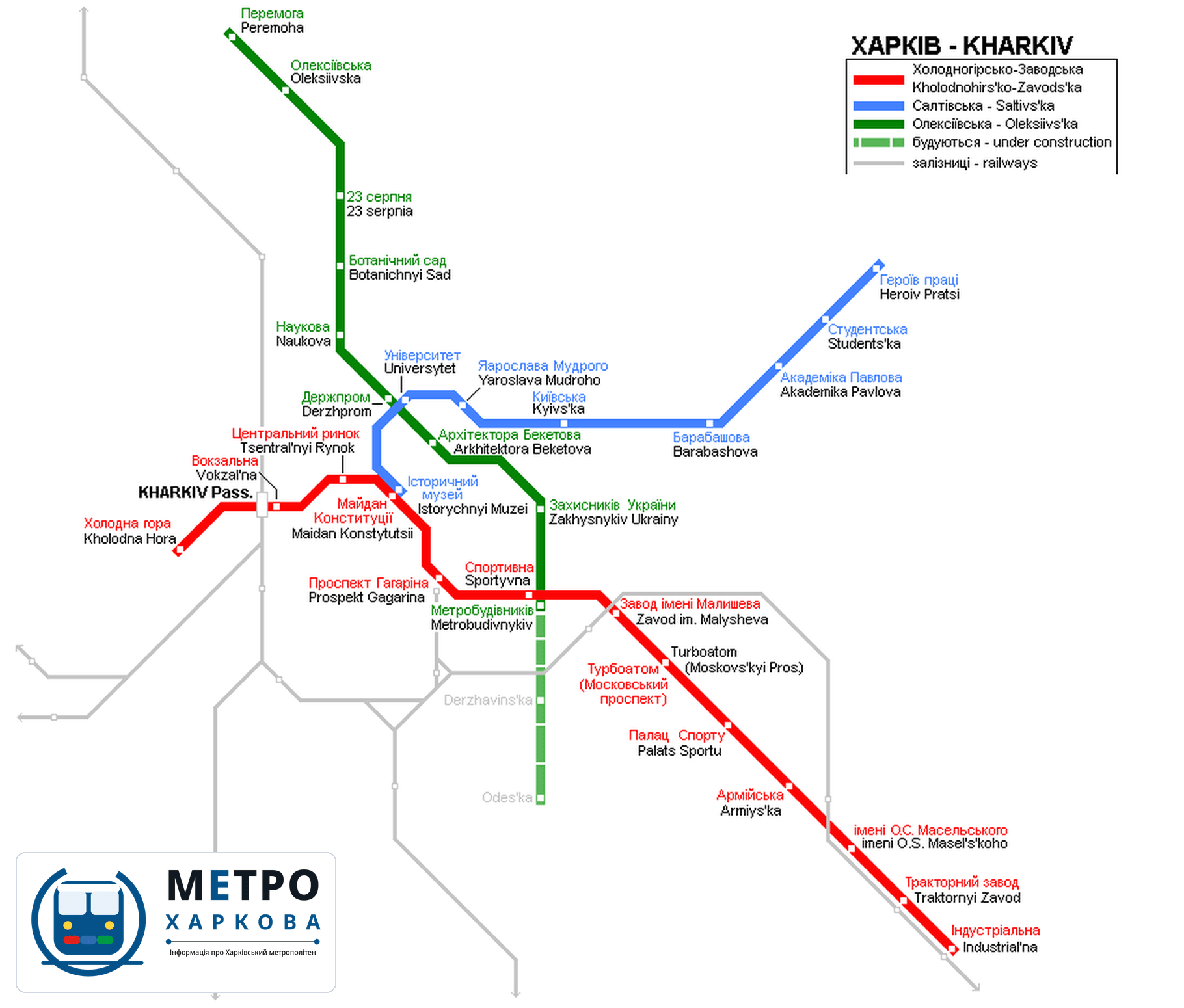
The whole Kharkiv Metro network — three lines, 30 stations and the transfer hubs. Download the map below as PNG or PDF.

Information updated: July 2026

Kharkiv Metro network diagram

Kharkiv Metro network map — Kholodnohirsko-Zavodska, Saltivska and Oleksiivska lines

For live service updates, check the official metro and city channels. Station names on the map are bilingual (Ukrainian + Latin).

Kharkiv Metro map PDF — download

Download the up-to-date Kharkiv Metro map as a PDF — it prints in full quality, scales without blurring and works offline: all three lines, 30 stations and the transfer hubs always at hand, even without internet.

Lines

L1Kholodnohirsko-Zavodska Line
Kholodna Hora ↔ Industrialna
13 stations · Red Line
L2Saltivska Line
Istorychnyi Muzei ↔ Saltivska
8 stations · Blue Line
L3Oleksiivska Line
Peremoha ↔ Metrobudivnykiv
9 stations · Green Line

Frequently asked questions

The Kharkiv Metro has 30 stations on three lines, about 38 km in total.

Right on this page — click “Map PDF” and the file saves to your device. A PNG version is also available. Both are free, print-friendly and work offline.

Via one of the three transfer hubs: Maidan Konstytutsii ↔ Istorychnyi Muzei, Sportyvna ↔ Metrobudivnykiv and Universytet ↔ Derzhprom. The underground walkways take 3–5 minutes.

Yes — in 2026 construction starts on the Oleksiivska Line extension from Metrobudivnykiv to Derzhavinska and Odeska (3.5 km), the network’s first expansion in a decade.

Contents